Best Printable Flag Worksheets for Smart Practice
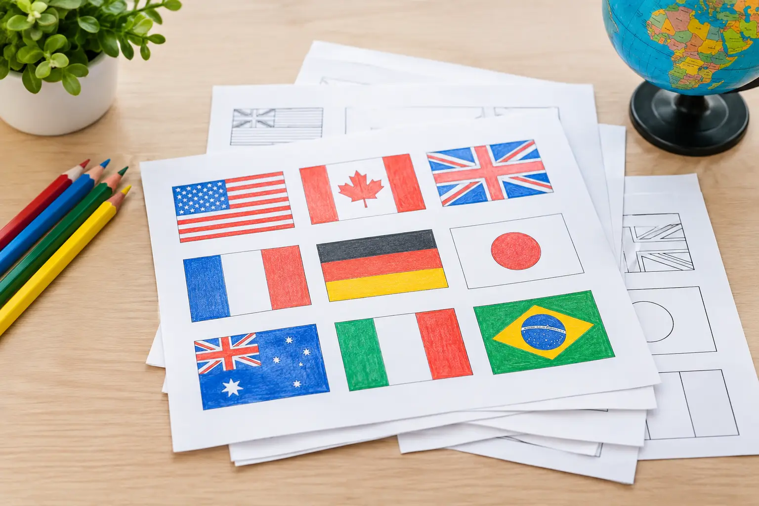
A blank outline of a flag can reveal more than a memorization drill. It can spark a question about a country, a region, or a story behind the colors. The best printable flag worksheets turn that moment of recognition into active geography practice - whether you have five minutes before class, a rainy afternoon at home, or a trivia night to prepare for.
A good page is not simply a grid of tiny flags with impossible-to-read labels. It gives learners one clear challenge, enough visual space to think, and a reason to remember the answer after the pencil is down. That is the difference between printing a worksheet and creating a game worth replaying.
What makes a flag worksheet worth printing?
The best choice depends on who is using it. A first grader learning to recognize the U.S. flag needs a different task from a high school student preparing for a world geography quiz. Adults often want a quicker, tougher format: fewer clues, more similar-looking flags, and no oversized graphics.
Start with the learning goal. If the goal is simple recognition, use a match-the-flag-to-the-country page. If learners need to connect countries to place, choose a worksheet that pairs flags with a world map or continent map. If the goal is recall under pressure, a no-label quiz is the better test.
Print quality matters more than it seems. Flags rely on small details: the arrangement of stars, a diagonal stripe, a coat of arms, or the difference between similar reds and blues. Choose worksheets with sharp, high-contrast images and enough white space to prevent one flag from blending into the next. A page that looks good on a screen can become muddy on a home printer.
Accuracy is non-negotiable. Flags change, and some worksheets keep outdated designs long after a country has adopted a new one. Check that names, borders, spellings, and flag versions are current. It is also worth looking for material that treats places carefully, especially territories and countries with disputed status. Geography is more interesting when it is taught with precision.
Best printable flag worksheets by activity
Flag-to-country matching sheets
Matching worksheets are the easiest entry point because they provide a useful clue: the list of possible country names. Learners can scan the options, eliminate obvious mismatches, and build confidence with each correct line.
These work especially well for a focused set of eight to fifteen flags. A full page of every national flag can be fun, but it often becomes a visual marathon. Start with a continent, a classroom unit, countries represented in your community, or nations competing in a major event. Smaller sets produce more repeatable practice.
For an extra challenge, remove the country bank on a second round. The first sheet teaches recognition. The second shows what actually stuck.
Label-the-flag quizzes
A label-the-flag worksheet shows flags without country names and asks players to write each answer. This format is better for measuring recall than matching, since there are no visible options to narrow down.
The strongest versions group flags by theme. Try European flags with vertical tricolors, Caribbean flags with bold geometric designs, or countries that share red, white, and blue. The theme gives the quiz a little structure without handing over the answer.
Avoid filling a page with only easy flags. Mix familiar designs with a few that require close observation. A memorable quiz might place Canada next to Austria, Japan next to Bangladesh, or Romania next to Chad. The point is not to trick people. It is to train them to notice the features that make each flag distinct.
Color-the-flag pages
Coloring pages are useful for younger learners, but they are not only for young kids. Recreating a flag forces attention to pattern, direction, symbols, and color placement. A learner who colors the blue triangle and white star on Cuba's flag is far more likely to recognize it later.
For this type of worksheet, include a small completed reference flag beside the blank version. That keeps the task centered on observation rather than a frustrating search for the correct colors. If printer ink is limited, black-and-white outlines are ideal.
Add one short fact below each flag, such as the country’s capital or continent. Keep it brief. The flag remains the main challenge, while the extra detail gives it a place in the learner’s mental map.
Flags and maps worksheets
Recognition becomes real geography when a flag is connected to location. Map-based worksheets can ask learners to place a flag number on a map, color the matching country, or draw a line from a flag to its region.
This format is particularly effective after a matching or labeling activity. First, identify the flag. Then, find the country. That two-step process prevents learners from knowing a design in isolation while having no idea where the nation is located.
For beginners, use a map with country names already printed. For more advanced groups, use a numbered map and a separate answer section. The right level is the one that makes players pause, not quit.
Flag clue and logic pages
Clue worksheets add a little mystery. Instead of showing a country name, they offer hints such as located in West Africa, has a capital beginning with A, or uses a flag with a single yellow star. Players use the clues to identify the country and then select or draw its flag.
These pages are great for mixed-age groups because they reward different kinds of knowledge. One player may recognize the flag immediately. Another may solve it through capitals, regions, languages, or landmarks. Everyone has a way into the challenge.
How to choose the right difficulty
A worksheet should create a few wins early. If every flag is unfamiliar, the activity feels like a test before it feels like a game. Begin with five or six recognizable flags, then add harder ones as the set grows.
For elementary learners, clear silhouettes, larger flags, and continent-based sets are usually enough. For middle school students, add country names, capitals, and basic map placement. For teens and adults, use timed rounds, similar-flag comparisons, and clue-based questions that require deduction.
There is a trade-off between speed and depth. A ten-flag rapid quiz is perfect as a warm-up or travel activity. A map-and-fact packet takes longer but builds stronger context. Use the fast version to build a habit, then use the deeper version when there is time to explore why the answers matter.
Turn printed practice into a mini game
A worksheet gets more energy when it has a simple rule. Set a timer for three minutes, give one point for each country name, and award a bonus point for placing the country on a map. Keep scores light. The goal is friendly competition, not turning every wrong answer into a penalty.
For a class or family group, try a pass-and-play round. One person covers the country labels, another identifies as many flags as possible, and then both check the answer key together. Talk through the misses. A quick comment like, The stripe order is reversed, makes the correction stick better than silently marking an X.
You can also build a weekly routine. Print one short regional worksheet on Monday, revisit it on Wednesday without labels, and finish Friday with a mixed quiz. Between print rounds, a quick daily flag puzzle such as Flagdle can keep the recognition habit active without adding homework.
A simple quality checklist before you print
Before choosing a page, ask whether the flags are large enough to see, the answers are available, the country names match the learner’s level, and the task has one obvious instruction. If any of those answers is no, skip it.
Also consider the practical details. A colorful page may be engaging but expensive to print. A two-sided packet saves paper but makes answer checking less convenient. A worksheet with cut-out cards is excellent for group play, though it needs more setup. There is no single best format - only the best fit for the time, printer, and people in front of you.
The next time a flag catches your eye, do not rush to name it and move on. Notice the shape, the colors, the symbols, and the part of the world it might point to. That small pause is where a printable page becomes a bigger map in your head.